Analysis Reports
Recent Projects
Read about more solutions
Sustainability Matters, Church Edition, Winter 2012
Diocesan and Parish Information Management
USING GIS TECHNOLOGY TO ASSIST IN YOUR CHURCH PLANNING
AND MANAGEMENT PROCESS
 Geographic Information System (GIS) technology has been around for more than 30 years. Essentially the marriage of computer-based database technology and computer-based graphics technology with a focus on spatial relationships, GIS is used by Federal agencies, State and local governments, and Commercial companies. Even the general population has become accustomed to utilizing computerized mapping technology to assist in generating ad-hoc maps of areas of interest, routing within personal vehicles utilizing Global Positioning System (GPS) technology, or viewing pending weather.
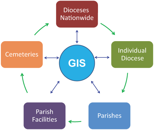
Churches have begun to understand that the use of GIS technology can assist in the understanding of where needs exist for services versus the availability of resources to meet those needs. As our society migrates from urban to suburban to rural environments and back again, having an awareness of those migration patterns that occur over 10-20 year timeframes or longer are helpful in planning for pastoral needs. Understanding how demographics within a region—race, age, ethnicity, etc.—are changing. How the needs of the those population groups differ can also assist church planners in understanding what church, school facility, or program requirements are for a region.
With over 15 years of GIS experience, Spatial Systems Associates (SSA) has been assisting faith-based organizations since 1998 to productively and effectively use mapping technology to assist in their analysis and planning efforts. We invite you to review the variety of mapping products available in these pages to understand how GIS technology can assist your organization.
Our Services and Solutions
Parish Analysis and Planning
- Parish boundary and facility mapping
- Parishioner mapping
- Thematic displays of demographic data and trends
School Analysis and Mapping
- School location mapping—parochial, public, and private
- Student location mapping
- Drive time characteristics
- Population/demographic/income trends
Real Property Asset Inventory and Management
- Research and mapping of diocesan real property buildings
- Valuation and report generation
- Space management
- Energy monitoring
- Indoor environmental monitoring
- Site management
- LEED® certification
Cemetery Management
- Plot availability
- Records management
- Parish legacy
Analyses
As needed analysis and report generating, using GIS technologies—i.e. parish/school viability, marketing for students
Web Services
SSA has the ability to create a web-based mapping interface to provide comprehensive information to a diocese—including parish-specific details and comparisons.
Please contact us today!


